Hiking Picos de Europa in Autumn: What to Expect
Hiking Picos de Europa in autumn means fewer crowds, vivid beech forest colour and unpredictable weather. Here's what to expect, trail by trail.
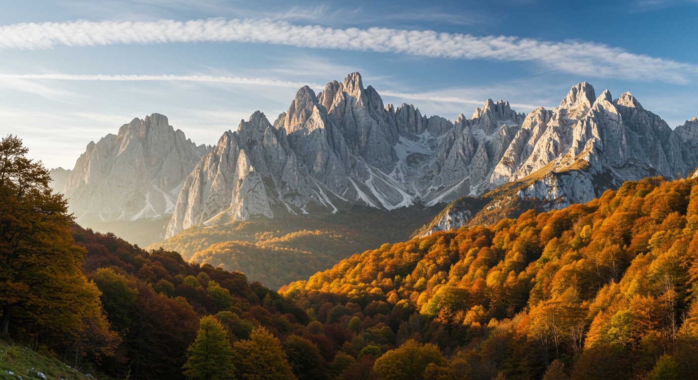
September and October transform the Picos de Europa into something close to absurd in its beauty. The beech forests above Sotres turn amber and copper almost overnight, the summer crowds thin to almost nothing, and the light in the late afternoon hits the limestone massifs at an angle that makes the whole place look slightly unreal. I've walked here in July and I've walked here in October, and it's not a close contest.
If you're searching for what hiking Picos de Europa in autumn conditions is actually like — not the brochure version — here's the honest picture. The trails are damp from September rain, the high-altitude routes above 2,000 metres carry real risk of early snow by late October, and a handful of mountain refuges close around the first of November. Plan accordingly. But for anyone willing to layer up and read the forecast carefully, this is the best time of year to be in Spain's most dramatic mountain range.
What the Picos de Europa Actually Is
The park straddles three regions — Asturias, Cantabria and Castilla y León — and covers roughly 67,000 hectares. It was Spain's first national park, designated back in 1918, though the boundaries have been extended since. The terrain is karst limestone: jagged, porous, disorienting. Trails that look short on a map involve serious elevation change, and the rock underfoot is slippery when wet. Which, in autumn, is often.
There are three main massifs — the Western (El Cornión), Central (Los Urrieles) and Eastern (Ándara). Most walkers head for the Central massif, partly because the Fuente Dé cable car in Cantabria offers a shortcut to high ground, and partly because it contains the classic routes around Bulnes and the Cares Gorge. The Eastern massif gets far less attention and is worth the extra effort to reach.
The Cares Gorge in Autumn: Still Worth It, But Go Early
The Ruta del Cares is the park's most walked trail — a 12-kilometre path carved into the cliff face above the Río Cares, linking Caín (León side) to Poncebos (Asturias side) or vice versa. In summer it's essentially a queue. In October, on a Tuesday morning, you might have it largely to yourself.
The route itself is not technically difficult. It's narrow in places, with a sheer drop to the river below, but there's no scrambling and the path is well-maintained. Round trip from Caín takes four to five hours at a relaxed pace. The autumn light in the gorge is exceptional — the limestone walls seem almost white against the dark water far below.
The practical issue in autumn is the drive to Caín. The road from Posada de Valdeón is single-track and closes to through-traffic during peak summer hours, but by October those restrictions lift. Parking at Caín is limited; arrive before 9am or accept a twenty-minute walk from where you've abandoned your car on the verge. There's a small bar at the Caín end that does bocadillos and coffee — nothing fancy, but it's open through October.
Skip the shuttle buses from Poncebos. They're slow, expensive relative to what they offer, and in autumn you won't need them.
Bulnes and the Ascent from Poncebos
Bulnes is a village of around thirty permanent residents that has no road access. You either take the funicular from Poncebos (€8–9 return, as of 2026 — check current fares at the ticket office) or you walk the old mule path, which takes about an hour and a half and gains 600 metres. In autumn, with wet leaves on stone steps, the walk up is slippery enough to warrant proper boots. Trainers are not appropriate here regardless of what you see other people wearing.
The village itself splits into two hamlets — Bulnes de Arriba and La Villa below. There's a small bar-restaurant in La Villa, Casa Cipriano, that serves a decent menú del día and has a few rooms. Ring ahead to check they're open; some smaller mountain establishments in the Picos start reducing hours from mid-October. The funicular typically runs year-round but may suspend service in high winds, which are more frequent in autumn. Check the Teleférico de Bulnes website or call the day before if you're counting on it.
High Routes: The Lagos de Covadonga and the Fuente Dé Area
The Lagos de Covadonga — Lago Enol and Lago Ercina — sit at around 1,100 metres in the Western massif and are the park's most accessible high-altitude scenery. In summer, the access road closes to private vehicles and you're bussed up from Cangas de Onís. In autumn, that restriction lifts (usually around mid-September, though the exact date varies by year — check the park website before you go). Driving up yourself is a different experience entirely.
From the lakes, there are several circular walks ranging from ninety minutes to a full day. The path to the Mirador del Príncipe takes about an hour from Lago Enol and gives views back over the whole western massif. In October, with frost on the grass in the morning and beech trees turning below, it's one of the better hours you can spend outdoors in Spain.
Fuente Dé, on the Cantabrian side, is the launchpad for the high Central massif routes. The cable car (Teleférico de Fuente Dé) rises 753 metres in four minutes and deposits you at 1,823 metres, from where the route to Cabaña Verónica and the Horcados Rojos ridge begins. This is serious mountain terrain. Above 2,000 metres in October, you can encounter snow, ice, cloud that drops visibility to ten metres, and winds that knock you sideways. The Horcados Rojos route is not appropriate for inexperienced walkers in poor autumn weather. Come back in September if you want more margin.
The cable car at Fuente Dé typically runs from around 9am to 6pm in autumn, but suspends in high winds. There's a parador at the base — expensive for what it is, but the bar is open to non-guests and the terrace views are hard to argue with.
The Eastern Massif: Ándara
Almost nobody goes to Ándara. That's partly because access from the Cantabrian village of Sotres involves a rough track that's impassable in a low-clearance car, and partly because there's no cable car shortcut and no famous gorge. What there is: an almost total absence of other walkers, extraordinary high-plateau terrain, and the ruins of old zinc mines at around 1,700 metres that give the landscape a slightly eerie quality.
The route from Sotres to the Refugio de Ándara (unstaffed, basic shelter — check current condition before relying on it) takes three to four hours and gains around 900 metres. In clear autumn weather, the views south into Castilla y León are extraordinary. In cloud, you're navigating on GPS and the paths are far less obvious than in the other massifs. This is a route for confident navigators only.
Sotres itself is worth a night regardless. It's a working farming village at 1,050 metres with a couple of casas rurales and a bar that doubles as a general store. The road up from Arenas de Cabrales is one of the most dramatic drives in northern Spain.
Practical Autumn Logistics
The park has no entry fee. Most trails are waymarked (red and white GR markings for long-distance routes, yellow and white PR for local paths), but waymarking quality varies and some signs are damaged or missing. Download the IGN topographic maps to your phone via the Wikiloc or IGN apps before you leave mobile coverage — which happens quickly once you're in the valleys.
Weather changes fast. I've started a walk in Arenas de Cabrales in sunshine and been in thick cloud at altitude within ninety minutes. The AEMET mountain forecast for Picos de Europa is the one to use; the general Asturias or Cantabria forecast is too broad to be reliable for the high terrain.
Base towns worth knowing: Cangas de Onís (Asturian side, most services), Arenas de Cabrales (Asturian side, closer to the central massif), Potes (Cantabrian side, good access to Fuente Dé), and Posada de Valdeón (León side, closest to Caín and the gorge). All have accommodation through October; Posada de Valdeón gets very quiet by late October and some guesthouses close.
If you're planning an extended stay in the region — or anywhere in northern Spain — and you're sorting out the bureaucratic side of living here, the practical steps around getting your NIE and TIE sorted are worth reading before you arrive. The queues at foreigner offices in Asturias and Cantabria are less brutal than Madrid or Barcelona, but they still require planning.
Gear and Footwear: The Honest Version
Waterproof boots. Not water-resistant trainers, not trail runners with a Gore-Tex label — proper ankle-height waterproof boots with a stiff sole. The Picos limestone is unforgiving on wet days, and in autumn you will have wet days. A mid-layer and a waterproof shell are non-negotiable above 1,500 metres. Trekking poles are useful on the descent from anywhere with significant elevation; the Bulnes mule path in particular.
A headtorch if you're doing anything more than a two-hour valley walk — autumn daylight in northern Spain runs out by 7pm (6pm once the clocks change in late October) and it gets dark fast in the valleys.
Getting There
The nearest airports are Asturias (OVD), Santander (SDR) and León (LEN). Asturias is the most useful for the western and central massifs; Santander for the Cantabrian approaches. There is no practical public transport into the park itself. You need a car. Hire one at the airport — or in Cangas de Onís if you arrive by bus from Oviedo and collect it there.
If you're relocating to Spain and planning to use northern Spain as a base, the question of renting without a Spanish payslip comes up almost immediately — rural Asturias and Cantabria have a different rental market to the cities, but the same landlord expectations apply.
The Picos in autumn rewards people who do a little homework and don't assume it'll be like hiking in the Alps with better food. It won't be. It'll be muddier, quieter, and considerably more atmospheric. Go in the first three weeks of October if you can. After that, the weather lottery gets less favourable and the beech colour starts to fade.
Frequently asked questions
- Is hiking Picos de Europa in autumn safe for beginners?
- Valley routes like the Cares Gorge and the paths around the Lagos de Covadonga are suitable for reasonably fit beginners in autumn, provided you have waterproof boots and check the weather forecast. High-altitude routes above 1,800 metres — particularly in the Fuente Dé area and the Ándara massif — carry real risk in October due to early snow, ice and rapid weather changes, and should be left to experienced mountain walkers.
- When do mountain refuges close in the Picos de Europa?
- Most staffed refuges in the Picos close around the end of October or early November, though exact dates vary by year. The Refugio de Ándara in the eastern massif is unstaffed and basic year-round. Always check directly with the specific refuge before planning an overnight trip in autumn — contact details are on the Parque Nacional Picos de Europa website.
- Can you drive to the Lagos de Covadonga in autumn?
- Yes. The access road restriction (which forces summer visitors onto shuttle buses from Cangas de Onís) typically lifts around mid-September, allowing private vehicles to drive to Lago Enol and Lago Ercina directly. The exact date changes year to year, so check the park's official website before your visit.
- What is the best base town for hiking the Picos de Europa?
- It depends which part of the park you want to explore. Cangas de Onís has the most services and is good for the western massif and Covadonga. Arenas de Cabrales is better positioned for the Cares Gorge and Bulnes. Potes on the Cantabrian side gives easy access to Fuente Dé. For the León side of the gorge, Posada de Valdeón is the obvious choice, though it's very small and quiet by late October.
- Is there mobile phone signal in the Picos de Europa?
- Patchy at best. In the main villages and valley floors you'll usually get some signal, but it drops quickly once you're on the trails. Download offline maps (IGN topographic or Wikiloc) and the AEMET mountain weather forecast before leaving your accommodation. Don't rely on Google Maps for navigation once you're above the valley.
- How long is the Cares Gorge walk?
- The route between Caín (León side) and Poncebos (Asturias side) is 12 kilometres one way. Most people walk it as a return trip from one end, which makes 24 kilometres and takes around four to five hours at a relaxed pace. The terrain is not technically difficult, but the path is narrow in sections with significant drops to the river below, so it's not suitable for anyone with a serious fear of heights.
- What should I wear hiking in the Picos de Europa in October?
- Waterproof ankle boots with a stiff sole are essential — the limestone is extremely slippery when wet. Bring a mid-layer (fleece or light down), a waterproof shell jacket, and waterproof trousers if you're going above 1,500 metres. A hat and gloves are worth packing from late September onwards. Trekking poles are useful on steep descents.